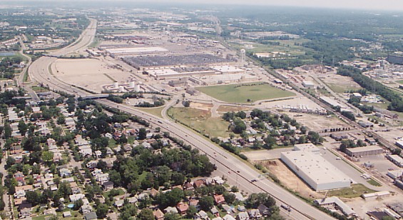
Recent view of the GE plant. (Larry Stulz photo)
What was to become I-75 was originally conceived in
the
1930's as a 50 mile "regional superhighway" connecting Cincinnati and
Dayton.
The new highway was to utilize the obsolete Miami-Erie canal route
between
the two cities and was to be modeled after the recently completed
Pennsylvania
Turnpike. The first segment was hastily constructed in 1941 to provide
access to the Wright Aeronautical Plant, located about 12 miles north
of
downtown Cincinnati. The sprawling plant employed 20,000 by 1942,
manufacturing
engines for RAF fighters and American B-29's. All heavy bombing of
Japan, including the incendiary bombing of Tokyo in 1945 and the atomic
bombings of Hiroshima and Nagasaki in August of that year were carried
out by B-29's outfitted with engines manufactured at this plant.
Recent view of the GE plant. (Larry
Stulz photo)
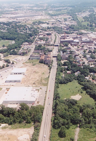
What was alternately called the "Wright Highway", "Lockland Highway", or "Wright-Lockland Highway" was a six lane highway that stretched about four miles between Hartwell Ave. and Glendale-Milford Rd. It was built along the path of the old Miami-Erie canal, which fell into disuse by the late 1800's.
The original Wright-Lockland Highway in the vicinity of the GE plant was rebuilt in the 1970's. The southernmost remaining mile of the Wright-Lockland Highway was reconfigured when the sprawling Cross County Highway interchange was constructed in the early 1990's. So only the segment through Lockland remains mostly unchanged.
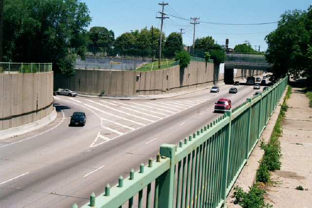
I-75 southbound through Lockland -- original segment
of the Wright Highway.
The GE plant is at top left and I-75 north is to the
right of this photo. (Larry Stulz
photo)
What was to become miles 8 and 9 of I-75 broke ground on December 4, 1947. This two mile extension of the Wright-Lockland Highway ran south from Hartwell Ave. to Elmwood Place, and included the Elmwood Place and Paddock Rd. interchanges. This section was soon after improved in the 1950's with the addition of emergency shoulders.
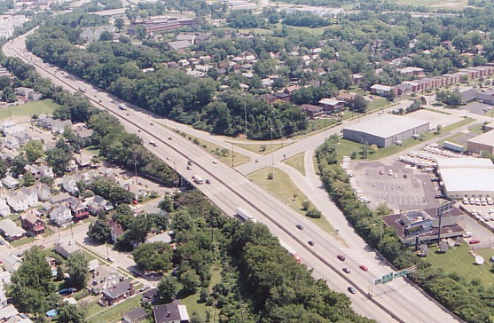
The partial Elmwood Place interchange marks the
southernmost
point of construction in the 1940's. (Larry
Stulz photo)
Unfortunately I have not found any photos of the old Wright-Lockland Highway or description of the road's signage, lighting, or general appearance. Presumably the signage was of the crude sort still seen in some areas of the Northeast. Few photos were taken in the area during the war, and in fact no photos of the Wright Aeronautical Plant were published until 1945.
1. 1940's
2. 1950's
3. 1960's
4. 1970's-1990's
5. Recent
News and Future Plans