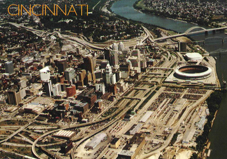
This unflattering post card from the late 1980's illustrates the pathetic condition of the riverfront
and how the expressway's width prevented continuity with the central business district.
Ft. Washington Way carries I-71,
U.S. 50, and provides access to downtown and the riverfront from I-75
and I-71. It was originally built from 1958-1961, and completely
reconstructed
between 1998 and 2000. The reconstructed Ft. Washington Way is the
newest
expressway in the Cincinnati area and is a major part of the city's
ambitious
riverfront redevelopment scheme. Click Here for
the original Ft. Washington Way article.
This unflattering post card from the late 1980's illustrates the
pathetic condition of the riverfront
and how the expressway's width prevented continuity with the central
business district.
A new two-level distributor road, called 2nd St.
(the
original 2nd St. was changed to Pete Rose Way in 1985, and is located a
few hundred feet to the south), was built along the south side of the
mainline
trench. Originally planned as an ordinary street elevated on
fill, instead 3,740ft. of it were elevated on precast concrete girders
spanning approximately 50ft.
![]()
Summer 2002 photo of the transit center under
construction.
[Tom Herbort]
The entire width is 84ft. The upper
level functions as an expressway distributor,
and
the lower level is the site of a bus staging facility known as the Riverfront
Transit Center. The subsurface Transit Center currently
serves buses but is planned to handle commuter and possibly intercity
trains in the future. The upper level 2nd St. is expected to
evenutally carry a light rail transit
line. At $18 million, the transit center was built at a fraction
of the cost of a traditional cut-and-cover tunnel.
The Riverfront Transit Center is located underneath 2nd St.
[Jake Mecklenborg November 2004]
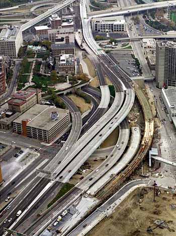
Fort Washington Way's original earth levee was
rebuilt as a concrete flood wall. The levee fill was moved a few
hundred feet south, to elevate Theodore Berry Way, a new street along
the
riverfront. Piles were sunk beneath center median and along the trench
walls which will eventually support a park directly above the mainline
trench. This "tunnel" is discussed in the Fort
Washington Way Tunnel section.
Reconstruction of the Broadway overpass in early 2000
[Parsons-Brinkerhoff Photo]
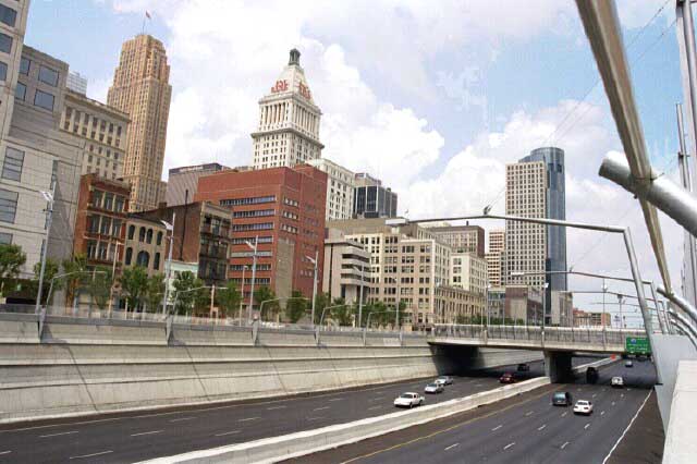
The newly rebuilt Ft. Washington Way is a dramatic
improvement
over the original in all aspects of traffic capacity, safety,
and aesthetics. In short it is
how the roadway should have been built originally, except for one
critical
aspect: the Broadway overpass. As it stands, the Broadway
overpass
is a hulking elevated structure that severely disrupts the
layout of the city in its immediate vicinity. The overpass was
necessary
in order to avoid rebuilding the entire Lytle Tunnel (as well as its
approach
to the north) deeper and in a different lane configuration.
Planners
used the Lytle Tunnel as a starting point for the new highway's design,
since it could not be rebuilt without considerable expense and
disruption
to the city.
A view of the Broadway overpass from Main St. The Queen
City Square office tower,
located at the intersection of Broadway and 3rd St., is seen under
construction.
[Jake Mecklenborg November 2004]
It would have been preferable for the expressway to
pass under Broadway in a trench similar to what exists for the next
quarter
mile east. Instead, downtown is cut off from the riverfront at
this
critical point, where the new Great American Ballpark was recently
completed
in early 2003. The proximity of the elevated expressway,
the
Riverfront Coliseum (now U.S. Bank Arena), and the severing of Sycamore
St. combine to place the new baseball stadium on the most aesthetically
awkward spot on the riverfront. As part of the
overpass reconstruction, Broadway itself was shifted east so as to
align with the Taylor-Southgate Bridge at Pete Rose Way, ameliorating
the awkward approach that had existed since 1898.
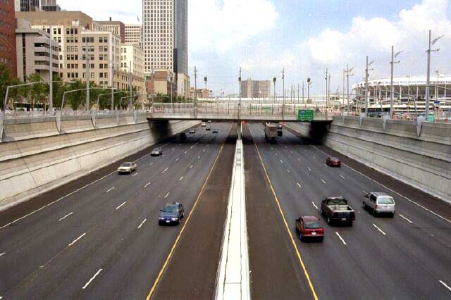
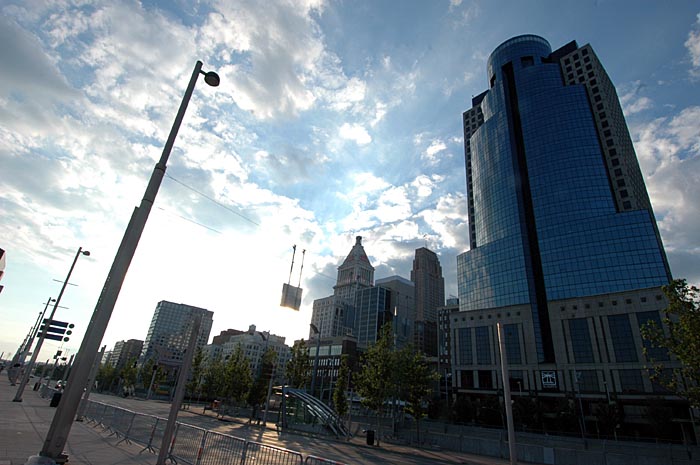
The new Ft. Washington Way trench in June 2001,
looking
east from Elm St.
[Jake Mecklenborg Summer 2001]
Photographs
1950's
construction Photos
1998
photos prior to reconstruction
1999
construction photos
2000
construction Photos
Aerial
Photos